

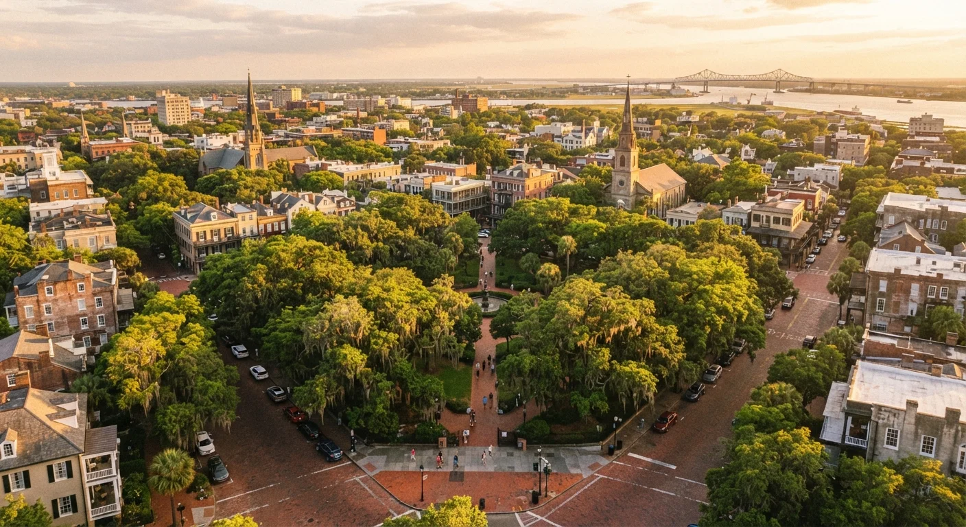
A City Designed From the Start for Foot Traffic
Most American cities were never really planned - they grew outward from a center, chasing commerce and population. Savannah is different. In 1733, General James Oglethorpe laid out the city on a deliberate grid built around a series of open squares, each surrounded by lots for civic buildings and private homes. That original design intention still shapes the experience of walking the city today.
The result is something rare: a historic urban core where the scale feels human. Blocks are short. Squares appear every few hundred feet, offering shade, a bench, and a sense of arrival. Rather than long, disorienting stretches of pavement, the grid breaks naturally into small, manageable segments. Visitors who might feel overwhelmed navigating larger cities often find Savannah's layout intuitive almost immediately.
What sets Savannah apart from other Southern cities goes beyond aesthetics - its physical structure actively encourages slowing down and exploring on foot in a way few comparable destinations can match.
22
Historic public squares in the city center
Savannah's original plan called for 24 squares; 22 survive today as public green spaces embedded in the street grid.
~1 sq mi
Area of the walkable historic district core
The densest concentration of landmarks, restaurants, and squares fits within roughly one square mile, making the district unusually compact by US city standards.
1733
Year Oglethorpe's grid plan was established
Savannah's original street plan is one of the oldest surviving urban grid designs in the United States, and remains largely intact today.
The Squares: More Than Decoration
Savannah's 22 public squares are the city's defining feature, and understanding them changes how you experience the place. Each square functions as a neighborhood anchor - a small park with mature trees, often Spanish moss-draped live oaks that filter sunlight into something golden and diffuse. They aren't just scenic backdrops. They're functional rest points that make longer walks feel less taxing.
Navigating by squares also gives walkers a natural orientation system. Instead of tracking block numbers, you move from Chippewa Square to Madison Square to Monterey Square, each one distinct enough to feel like a milestone. Many of Savannah's best-known landmarks sit directly on or around a square, so the walk between attractions is itself the experience rather than a gap between them.
“The squares of Savannah are not just ornamental - they are the connective tissue of the city's social life, providing rhythm and pause to what would otherwise be a straightforward grid.”
— Urban Planning Scholar, University of Georgia, Researcher specializing in historic American urban design
Practical Realities: What to Know Before You Walk
Walkable doesn't always mean frictionless. Savannah's historic streets include stretches of uneven brick and cobblestone - charming in photographs, but genuinely rough underfoot after a few hours. Comfortable, broken-in shoes are not optional; they're the difference between a pleasant afternoon and a miserable one.
Summer heat and humidity deserve honest acknowledgment. July and August in Savannah can feel punishing by midday, even with the oak canopy. Experienced visitors shift their walks to morning and early evening, retreating indoors during peak afternoon heat. Spring and fall offer the most forgiving conditions for extended exploration.
Plan Walks Around the Squares, Not Addresses
Rather than navigating Savannah by street addresses, orient yourself by which square you're heading toward next. It's more intuitive, more enjoyable, and turns the walk itself into part of the itinerary. A paper map of the squares - available at many visitor centers - is worth picking up even if you normally rely on a phone.
The city also runs a free shuttle service - the DOT (Downtown Savannah Transit) - that loops through the historic district and can give tired legs a break without requiring a car or rideshare. For a different kind of comparison in walkable urban planning, Washington D.C.'s grid and free cultural institutions offer an interesting counterpoint to Savannah's smaller, denser layout.
How Walkability Shapes the Savannah Experience
There's a particular kind of travel that Savannah rewards: unhurried, conversational, and open to detour. When a city is designed at walking scale, the rhythm of a visit changes. You notice the ironwork on a gate you'd have driven past. You duck into a courtyard because you can. You linger at a square bench because there's no car to get back to.
Savannah's food culture reinforces this. Outdoor seating is common, to-go cups are permitted on public streets in designated areas (verify current local rules before your visit), and the general pace of the city encourages staying out rather than rushing home. Walkability here isn't just a logistical convenience - it's embedded in how locals and visitors alike use the city socially.
For travelers who are accustomed to driving between attractions, Savannah can feel like a reorientation. That's largely the point. The city's enduring appeal rests on a design that makes getting somewhere feel like the reward, not just the means.
Frequently Asked Questions
The historic district is roughly one mile wide and about two miles long. Most visitors can cross it comfortably in 20 to 30 minutes, though you'll want to budget much longer once you start stopping at squares and storefronts along the way.
The core historic district is generally considered safe for evening walks and is well-frequented by tourists and locals alike. As with any city, it's wise to stay alert, stick to well-lit streets, and check local advisories before your visit.
For most visitors staying in or near the historic district, a car is largely unnecessary during the day. A combination of walking, the free DOT shuttle, and occasional rideshares covers most tourist needs. A car becomes more useful for visiting outlying areas like Bonaventure Cemetery or Tybee Island.
Spring (March through May) and fall (October through November) offer the most comfortable walking temperatures. Summer is hot and humid, though the oak canopy helps. Winter is mild by Northern standards, with daytime highs often in the 50s and 60s Fahrenheit.
Many streets in the historic district have improved accessibility in recent years, but cobblestone sections and uneven brick paths can pose real challenges for wheelchairs and strollers. Parallel paved sidewalks are often available, and it's worth researching specific routes in advance.
The content on this site is for informational purposes only and is not a substitute for professional advice. Always consult a qualified professional for guidance specific to your situation.